For a long time in the Civil 3D world, we have had labels that update based on the state of the model. Obviously, this saves eons of time given the large amount of annotations needed for plan approvals. Just look at all the labels just for a subdivision lot plan on one sheet!

As usage of Civil 3D tools expand into each plan, the project can become sluggish and even unbearable to use. Data shortcuts was introduced early on in the development of Civil 3D to help alleviate some of this DWG burden. But even then, plansets have also bloomed from simple 10-15 page sets into 100 page sets for the same size development. Even the most optimized project will get bogged down in the effort to keep these labels up to date.
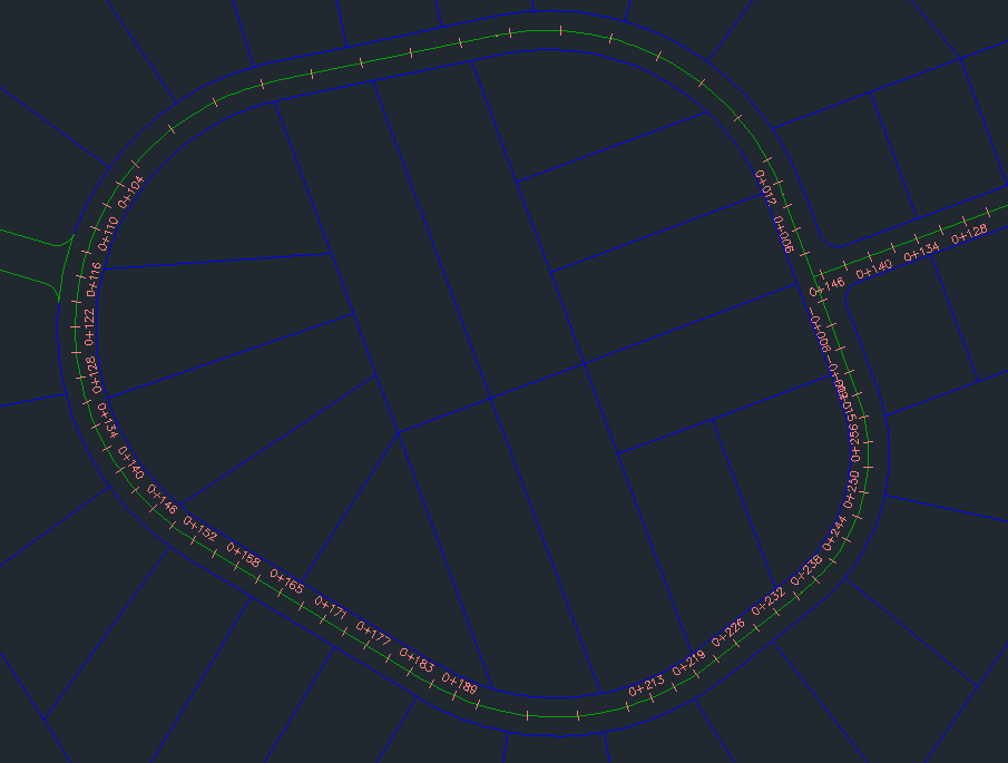
Let’s chat a bit about how these labels are maintained within Civil 3D. From the beginning labels react to changes to the reference object. In model space, this is simplified only because there is one modelspace to maintain. The complication is really needing all of those sheets. As you can imagine, plan views are often broken up into sections of the site in order to effectively display all of the required information. If we look at what happens to one contour label in model space, that single label will get regenerated for every viewport you have on all of your sheets in a single DWG file. Multiply that regen effort by the total number of labels and you can start to see the performance impact to the application. Wait, are you telling me a label outside of most views that likely only appears in one layout, gets regenerated again for all other viewports in all other layouts? Yes.
But in v2023.2, Autodesk introduced label functionality to improve that burden. YAY!
There are several Status Bar tools and options to assist in this performance improvement. First and foremost, AECCLABELOPTIMIZE turns off all labels outside of all views, including your model space view. Instantly, you should see performance improve on your sheets! With this improvement comes some nuance when in model space.
As soon as you Pan or Zoom, those labels are still invisible even if they would be inside your current view. An option inside the optimize tool is an ability to make Civil 3D redraw those labels automatically, Done.
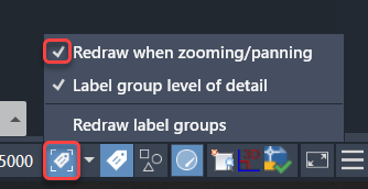
Additionally, if you zoom way out, most labels would be unreadable, sort of like road route numbers would dominate a map if all the 200′ scale labels are visible at 2000′ scale. To address this issue, we can turn on level of detail. Amazing!
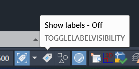
The last tool I want to introduce is TOGGLELABELVISIBLITY. This tool allows you to just turn off ALL LABELS in a DWG file. Talk about moving fast…
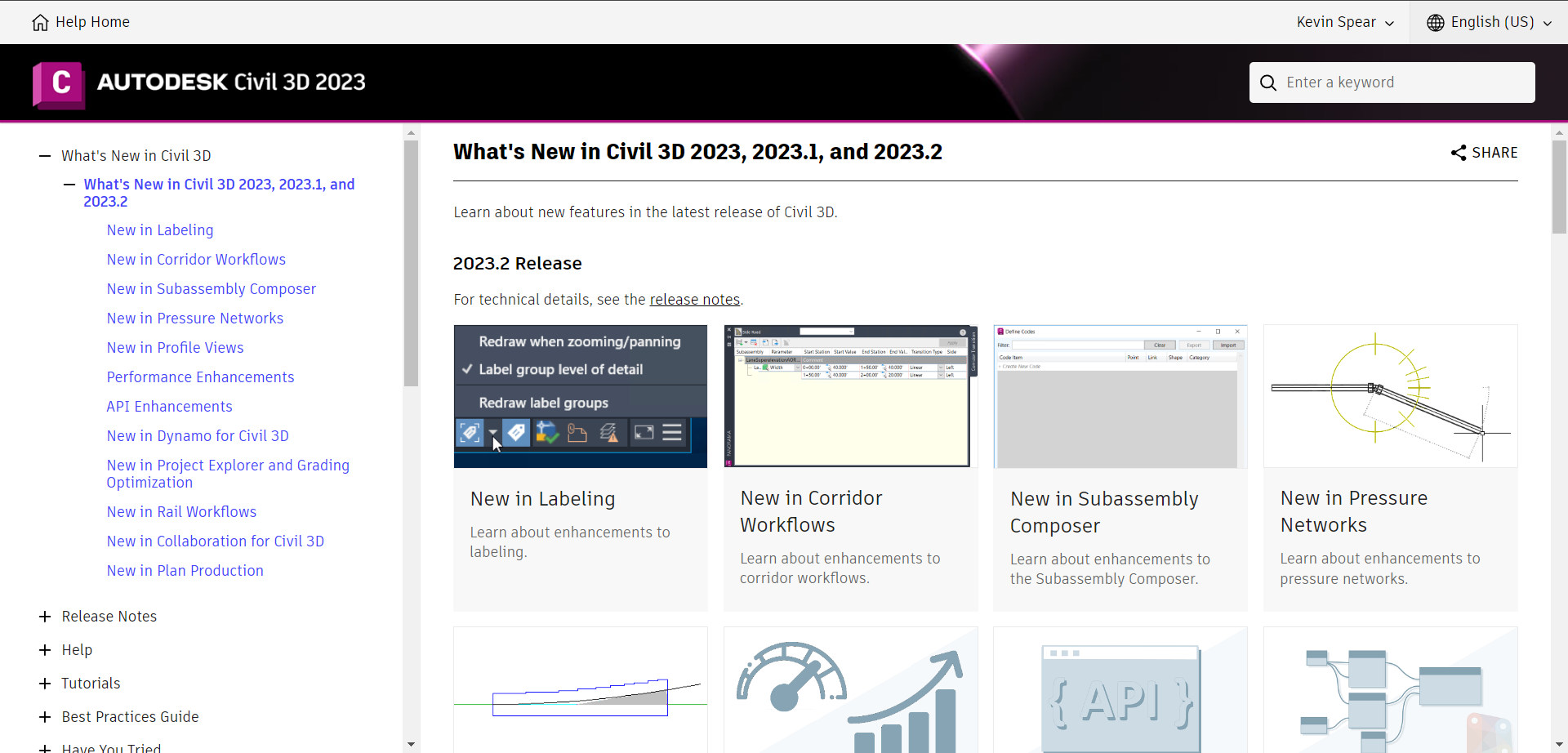
With each release of Civil 3D and intermediate release, there are new tools and workflows added all the time. Certainly, some tools will apply to your business and other tools will not. Just take a look in Help (F1) to find the What’s New section and browse what’s changed. You may be surprised to find the thing you’ve been wishing for has been there for more than a few years! These what’s new sections go all the way back to v2018.